Shenandoah River State Park
SH
350 Daughter of Stars Dr., Bentonville, VA 22610

npMQ8D
OWNER: Virginia Department of Conservation and Recreation
CONTACT: (540) 622-6840
WEBSITE: http://www.dcr.virginia.gov/state-parks/shenandoah-river#general_information
EVENTS: Events/Classes at this Park
GENERAL INFO:
Park Type: State Park
Overall Size: Larger than a football field
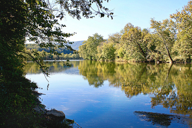
Special Features/Comments: This park is on the South Fork of the Shenandoah River and has more than 1,600 acres along 5.2 miles of shoreline. The park opened in June 1999. In addition to meandering river frontage, the park offers scenic views of Massanutten Mountain to the west and Shenandoah National Park to the east. A large riverside picnic area, picnic shelters, trails, river access and a car-top boat launch make this a popular destination for families, anglers and canoeists. Ten riverfront tent campsites, a campground with water and electric sites, cabins, camping cabins and a group campground are available. With more than 24 miles of trails and a new zipline, the park has plenty of options for hiking, biking, horseback riding and adventure.
GETTING THERE:
Parking
pDriving Directions: The park is in Warren County, 8 miles south of Front Royal and 15 miles north of Luray. It's off Rt. 340 in Bentonville.
From Northern Virginia, take I-66 West to exit 13 (Linden). Turn left off the ramp. Go one block to a stoplight where you'll take a right onto Rt. 55 West. At the fifth stoplight, turn left onto 340 South. Drive eight miles; the park's entrance is on the right.
From I-81 North, take exit 300 onto I-66 East. From I-66, take exit 6. Turn right off the ramp onto 340 South. Follow 340 South through Front Royal, then drive eight miles to the park's entrance on the right.
From I-81 South, take exit 264 to New Market and Luray. Turn right off the ramp. Turn left at the second stoplight, go one block to another stoplight and turn right onto 211 East. Stay on this highway for 15 miles, where you'll take a right exit onto 340 North. Drive about 12 miles to the park's entrance on the left.
Drive Times: Northern Virginia, one and a half hours; Richmond, two and a half hours; Tidewater/Virginia Beach, four and a half hours; Roanoke, two and a half hours
ACTIVITIES/RECREATION OPPORTUNITIES:
Trails, Fishing
AMENITIES:
General Park Amenities: Restrooms, Picnic Tables, Grills
Pets: Allowed On-Leash
Additional Features: Ornamental Gardens, Visitor Center, Nature Center, Gift Shop, Picnic Shelter, Bath House
Camping: Tent, RV, Groups
Camping Amenities: Running Water, Fires Allowed, Fire Rings, RV Hookups
TRAILS:
Trail Description: 24 miles, more than 14 miles of which are multi-use.
Trail Activities: Walking, Hiking, Running/Jogging, Bicycling, Mountain Biking, Horseback Riding, Dog Walking, Birdwatching
Trail Difficulty: Easy, Moderate, Difficult
Trail Layout: Loop & Linear (network)
Trail Length: Over 10 miles
Trail Shade: Some
Trail Width: 4-8 ft
Trail Extras: Kiosk with trail maps, Panoramic Views
OTHER:
Programming Available: Education/Ranger Programs, Junior Ranger Programs
Park Information: Maps, Brochures
Staffing & Safety: Employee/Ranger Present, Ranger Patrol
Open Space Activities: Go for a walk or jog, Have a picnic
Open Space Size: Larger than one football field in size
Open Space Shade: Some
Natural Water Feature: River/Channel
