Sailor's Creek Battlefield State Park
SC
6541 Saylers Creek Rd., Rice, VA 23966
nUpMQ8D
OWNER: Virginia Department of Conservation and Recreation
CONTACT: (804) 561-7510
WEBSITE: http://www.dcr.virginia.gov/state-parks/sailors-creek#general_information
EVENTS: Events/Classes at this Park
GENERAL INFO:
Park Type: State Park
Overall Size: Larger than a football field
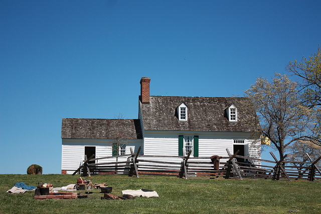
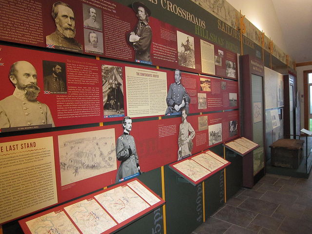
Special Features/Comments: On April 6, 1865, nearly a quarter of Confederate Gen. Robert E. Lee's army, more than 7,700 men, were killed, wounded or captured here. Lee surrendered 72 hours later at Appomattox Court House. Historical interpreters present various programs and living history events take place at various times throughout the year. Motorists traveling along Lee's Retreat may learn more about the battle through signs at each stop. Also, a free tour of the Overton-Hillsman House, which served as a hospital during and after the battle, may be arranged.
GETTING THERE:
Parking
pDriving Directions: The park is at 6541 Saylers Creek Road, Rice, Va. From U.S. 460, take Route 617 (Saylers Creek Rd.) to the park. From U.S. 360, take State Route 307 (connecting highway between U.S. 360 and U.S. 460) to Route 617 North (Saylers Creek Rd.).
Drive Time: Northern Virginia, three to three and a half hours; Richmond, one to one and a half hours; Tidewater/Norfolk/Virginia Beach, two and a half to three hours; Roanoke, two hours
ACTIVITIES/RECREATION OPPORTUNITIES:
Trails, Birdwatching
AMENITIES:
General Park Amenities: Restrooms, Picnic Tables
Pets: Allowed On-Leash
Additional Features: Visitor Center, Historic Site, Museum, Gift Shop
Trash Cans: Yes
Food for Sale Type: Gift Shop
TRAILS:
Trail Description: There are three hiking trails with interpretive signs. Visitors may take the Kershaw Trail (.8 miles), which leads to Sailor's Creek where the Union army traversed the battlefield to assault the Confederate position. The .8-mile Custis Lee Trail allows hikers to see where Gen. Custis Lee counter-attacked Union forces. At Marshall's Crossroads, signs on the .2-mile Pickett Trail describe the final fighting at Sailor's Creek.
Trail Difficulty: Easy, Moderate
Trail Layout: Loop & Linear (network)
Trail Length: 1 to 5 miles
Trail Shade: Some
Trail Width: 4-8 ft
Trail Extras: Historic Sites
OTHER:
Programming Available: Education/Ranger Programs, Junior Ranger Programs
Park Information: Maps, Brochures
Staffing & Safety: Employee/Ranger Present, Ranger Patrol
Open Space Activities: Go for a walk or jog, Have a picnic
Open Space Size: Larger than one football field in size
Natural Water Feature: Creek/Stream
