New River Trail State Park
NR
116 Orphanage Dr., Max Meadows, VA 24360

nUpMQ8D
OWNER: Virginia Department of Conservation and Recreation
CONTACT: (276) 699-6778
WEBSITE: http://www.dcr.virginia.gov/state-parks/new-river-trail#general_information
EVENTS: Events/Classes at this Park
MANAGED BY: VA Dept of Conservation and Recreation Unknown
PARK SIZE: 0.03 Acres
PLAYGROUNDS: 1
HAS TRAILS: yes
GENERAL INFO:
Park Type: State Park
Overall Size: Larger than a football field
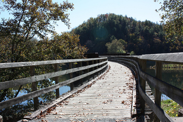
Special Features/Comments: New River Trail is a 57-mile linear park that follows an abandoned railroad right-of-way. The park parallels the scenic and historic New River for 39 miles and passes through four counties and the city of Galax. The trail's gentle slope makes it great for visitors of all ages to hike, bike and ride horseback. The park's Foster Falls area offers guided horseback trips; canoe and bike rentals; boat launches; gift shops; and a horse arena. Fishing is popular, and primitive campsites dot the trail. There are access points to the trail at Allisonia, Chestnut Yard, Cliffview, Dannelly Park (near Galax), Draper, Dora Junction (near Pulaski), Foster Falls, Fries, Galax, Gambetta, Hiwassee and Ivanhoe. Horse trailer parking is available at Allisonia, Austinville, Cliffview, Dora Junction, Draper, Fries, Ivanhoe and the Mark E. Hufeisen Horse Complex.
Two tunnels: 135 feet and 193 feet long
Three major bridges: Hiwassee - 951 feet; Ivanhoe - 670 feet; Fries Junction - 1,089 feet
Nearly 30 smaller bridges and trestles
A historic shot tower used more than 200 years ago to make ammunition
Potable water is available only at Galax, Cliffview Campground (Dannelly Park) and Foster Falls as well as at the horse trailer lots at Ivanhoe, Draper and Dora Junction.
Five non-flush toilets are available along the trail.
GETTING THERE:
Parking
pDriving Directions: There are several entrances into this park. The park meanders through Grayson, Carroll, Wythe and Pulaski counties and Galax in southwestern Virginia and parallels the scenic and historic New River for 39 miles.
Its address is 116 Orphanage Dr., Max Meadows, VA 24360.
Foster Falls: Latitude, 36.530512. Longitude, -80.512931.
Shot Tower: Latitude, 36.522000. Longitude, -80.522033.
Cliffview: Latitude, 36.408613. Longitude, -80.550665.
Drive Times: Charlotte, N.C., 2 hours; Knoxville, Tenn., 3 hours; Winston-Salem, N.C., 1 hour.
ACTIVITIES/RECREATION OPPORTUNITIES:
Trails, Outdoor Fitness Stations, Horse Stables, Equestrian Rings, Birdwatching, Fishing, Kayaking/Canoeing
AMENITIES:
General Park Amenities: Playground, Restrooms, Picnic Tables, Grills
Playground Surface Type: Mulch
Pets: Allowed On-Leash
Additional Features: Nature Center, Historic Site, Gift Shop, Picnic Shelter, Amphitheater
Trash Cans: Yes
Camping: Tent, Primitive
Camping Amenities: Overnight Camping, Fires Allowed, Fire Rings
TRAILS:
Trail Description: Hiking, bicycle trails, bridle trails.
Trail Activities: Walking, Hiking, Running/Jogging, Bicycling, Mountain Biking, Single Track, Horseback Riding, Dog Walking, Birdwatching
Trail Difficulty: Easy, Moderate
Trail Layout: Loop & Linear (network)
Trail Length: Over 10 miles
Trail Shade: Some
Trail Width: 4-8 ft
Trail Extras: Fitness/Exercise Stations, Mountain Biking Features, Panoramic Views, Historic Sites
OTHER:
Programming Available: Education/Ranger Programs, Junior Ranger Programs
Park Information: Maps, Brochures
Staffing & Safety: Employee/Ranger Present, Ranger Patrol
Open Space Activities: Go for a walk or jog, Have a picnic
Open Space Size: Larger than one football field in size
Natural Water Feature: River/Channel
