Lower Rouge River Trail
Morton Taylor Trail Head
Trail end points: Canton Center Rd. south of Palmer Rd. and I-275 Metro Trail north of Michigan Ave./US 12 48188
nUBpkTMQD

OWNER: Canton Leisure Services
CONTACT: 734-394-5310
WEBSITE: http://www.michigan.org/property/lower-rouge-river-recreation-trail
EVENTS: Events/Classes at this Park
Hours: 6am-10pm
GENERAL INFO:
Park Type: Green Space, Special Use, Stream Valley Park
Overall Size: Larger than a football field
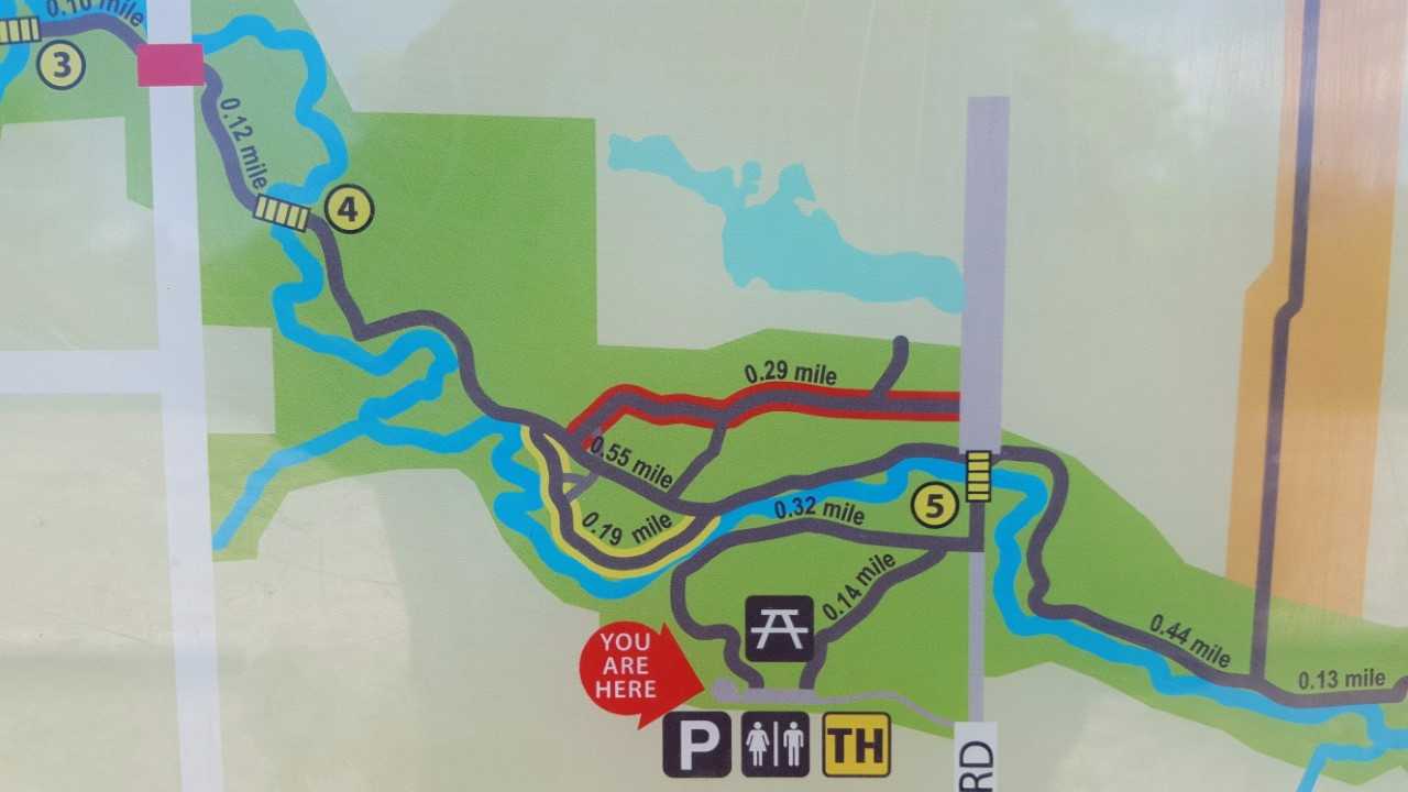
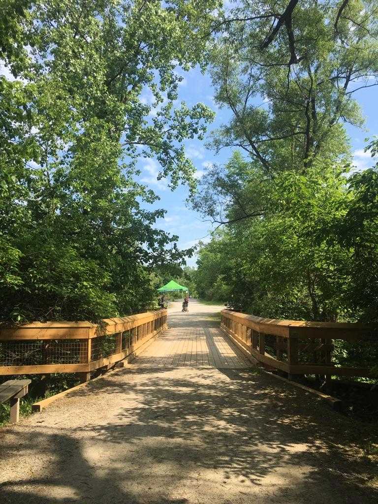
Special Features/Comments: The LRT is a ten-foot wide path made of crushed stone with 8 wooden bridges along the Lower Rouge River system. The trail also offers five miles of dirt surface, single track trails for hiking and mountain biking.
GETTING THERE:
Parking, Bike Racks
pDriving Directions: Morton Taylor Trailhead.
North of Michigan Ave off Morton Taylor Road
kParking Instructions: Limited on-site parking 30 spots 3 ADA Handicapped
TADA Accessible: Yes
ACTIVITIES/RECREATION OPPORTUNITIES:
Trails, Birdwatching
AMENITIES:
General Park Amenities: Restrooms, Seating, Picnic Tables
Pets: Allowed On-Leash, Bags Provided
Additional Features: Foot Bridge
Trash Cans: Yes
TRAIL DESCRIPTION:
Trail Surface: Unpaved
Trail Activities: Walking, Hiking, Running/Jogging, Bicycling, Mountain Biking, Dog Walking, Birdwatching
Trail Difficulty: Easy
Trail Layout: Loop & Linear (network)
Trail Length: 1 to 5 miles
Trail Shade: Lots
Trail Surface Type: Gravel, Natural rock, Sand/Dirt, Boardwalk
Trail Slope: Flat/Gentle
Trail Width: 8-12 ft
Trail Extras: Kiosk with trail maps, Benches/Rest Areas, Mountain Biking Features
OTHER:
Park Information: Information Kiosk
Staffing & Safety: Police Patrol
Natural Water Feature: Creek/Stream
