Spring Mountains National Recreation Area
Desert View Overlook
Deer Creek Rd, Las Vegas, NV 89166
nBpkTMQ8
OWNER: U.S. Forest Service
CONTACT: 702-872-5486
WEBSITE: https://www.fs.usda.gov/detail/htnf/about-forest/districts/?cid=fsm9_026952
EVENTS: Events/Classes at this Park
Hours: Always Open
GENERAL INFO:
Park Type: Federal Park Site
Overall Size: Larger than a football field
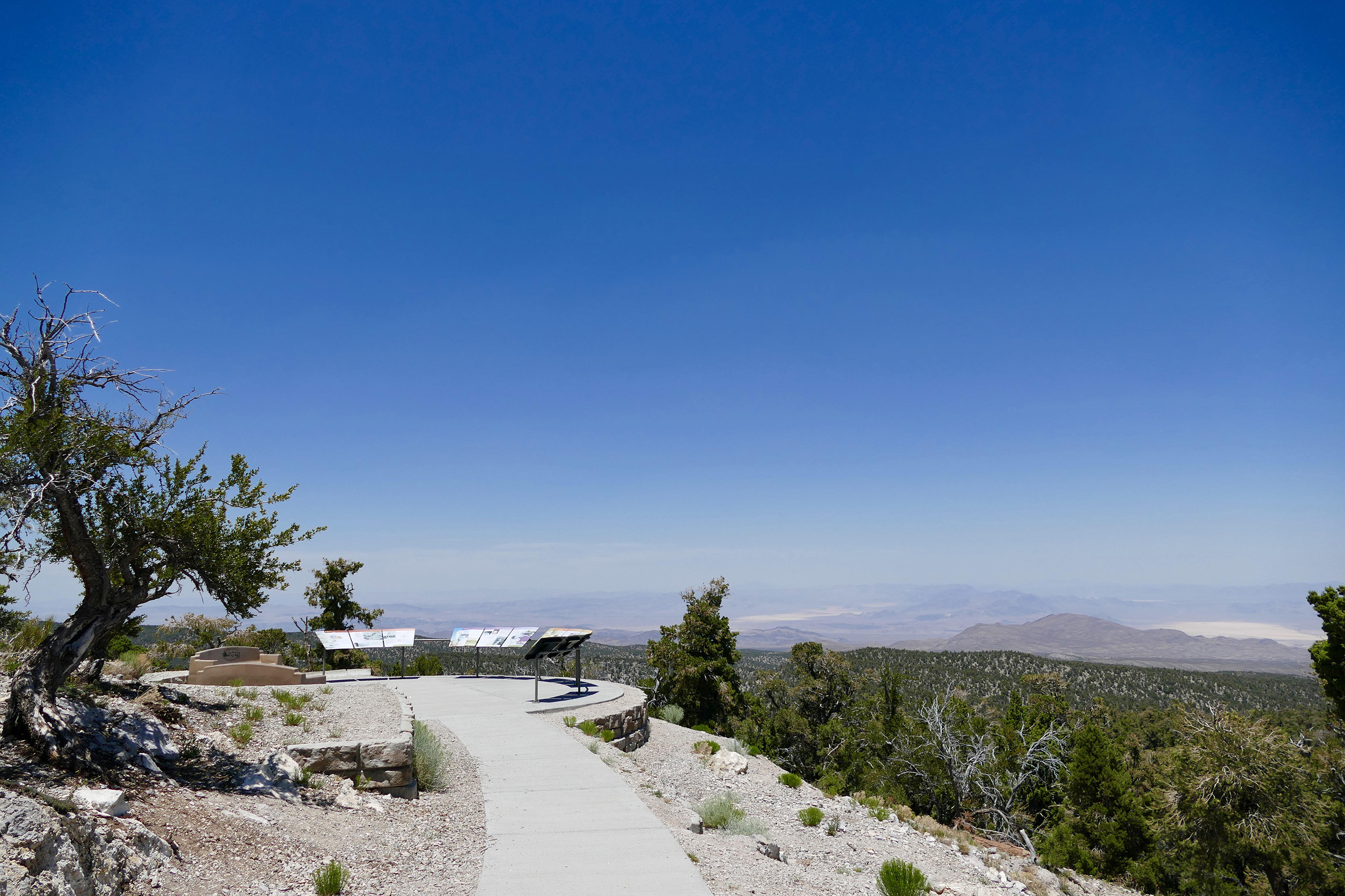
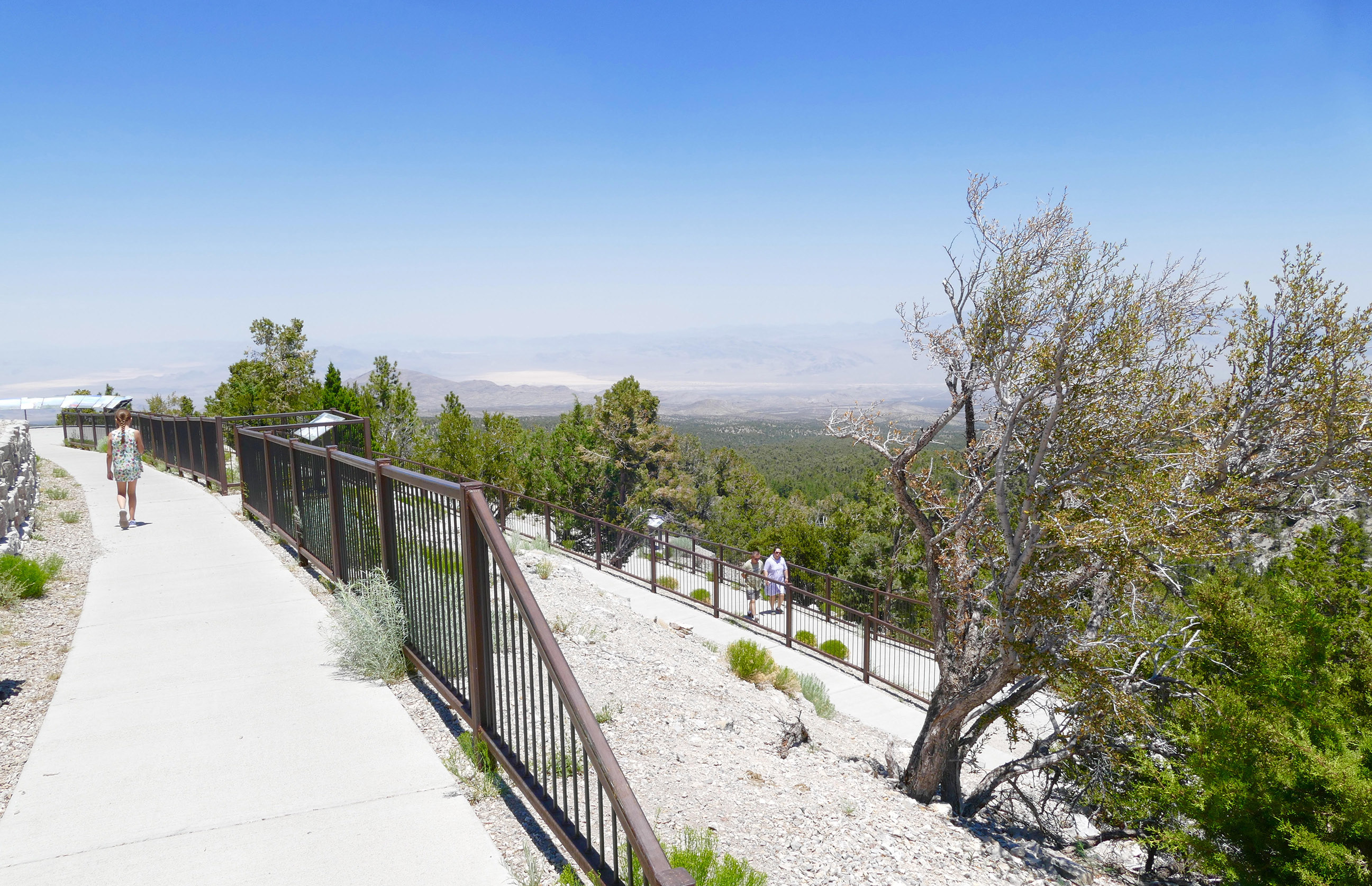
Special Features/Comments: The Desert View Overlook Trail is 0.1 miles of paved walkway that winds down to multiple viewing platforms past multiple educational panels.
GETTING THERE:
Parking
pDriving Directions: Coming from Las Vegas:
Take US-95 North. Drive past the Skye Canyon exit for 1 mile then turn left on Kyle Canyon Road/NV-157 and drive 18 miles. Turn right on Deer Creek Highway/NV-158 and continue on Deer Creek Highway approx. 7 miles then turn right into the Desert View Overlook parking lot.
Coming from the north:
Take US-95 South. Drive approx. 20 miles past the town of Indian Springs then turn right onto Lee Canyon Road/NV-156, drive approx. 14 miles then turn left on Deer Creek Highway/NV-158. Follow Deer Creek Highway approx. 1.5 miles to the Desert View Overlook parking lot.
kParking Instructions: Park at the Desert View Overlook parking lot. Trail begins at the north end of the parking lot.
TADA Accessible: Yes
ACTIVITIES/RECREATION OPPORTUNITIES:
Trails
AMENITIES:
General Park Amenities: Seating
Pets: Allowed On-Leash
Additional Features: Visitor Center, Gift Shop
TRAILS:
Trail Description: The Desert View Overlook Trail is 0.1 miles of paved walkway that winds down to multiple viewing platforms past multiple educational panels set in the trees and at key vantage points along the way. The Desert View Overlook has expansive views of the Mojave Desert and is known for being a great vantage point for bomb detonation viewing during the Atomic Era, and many of the panels share details about this era. Panels also share information about the flora, fauna, and geology of the surrounding mountains and dry lake beds. Trail is gently sloped with switchbacks to ease the elevation difference from the trailhead to the final viewing platform. Parking lot is open in winter but trail is not cleared of snow. The nearby Deer Creek Picnic Area parking lot has bathrooms.
Trail Surface: Paved
Trail Activities: Walking, Dog Walking
Trail Difficulty: Moderate, ADA Accessible
Trail Layout: Linear
Trail Length: Less than a half mile
Trail Shade: Little or none
Trail Surface Type: Concrete
Trail Slope: Moderate
Trail Width: 2-4 ft
Trail Extras: Benches/Rest Areas
OTHER:
Park Information: Information Kiosk
Staffing & Safety: Police Patrol
Open Space Activities: Do Yoga
Open Space Size: Between basketball court and football field
